Chippewa County, DATCP Help Dairy Farmer Fix Massive Gully
Bryon Swoboda knows the lands west of Chippewa Falls quite well. He grew up on a dairy farm there and now runs the family operation in partnership with his father. Over the last 18 years, the Swobodas have expanded their farm to 160 head of cattle, and grow hay and corn in rotation on approximately 120 acres of cropland for livestock feed.
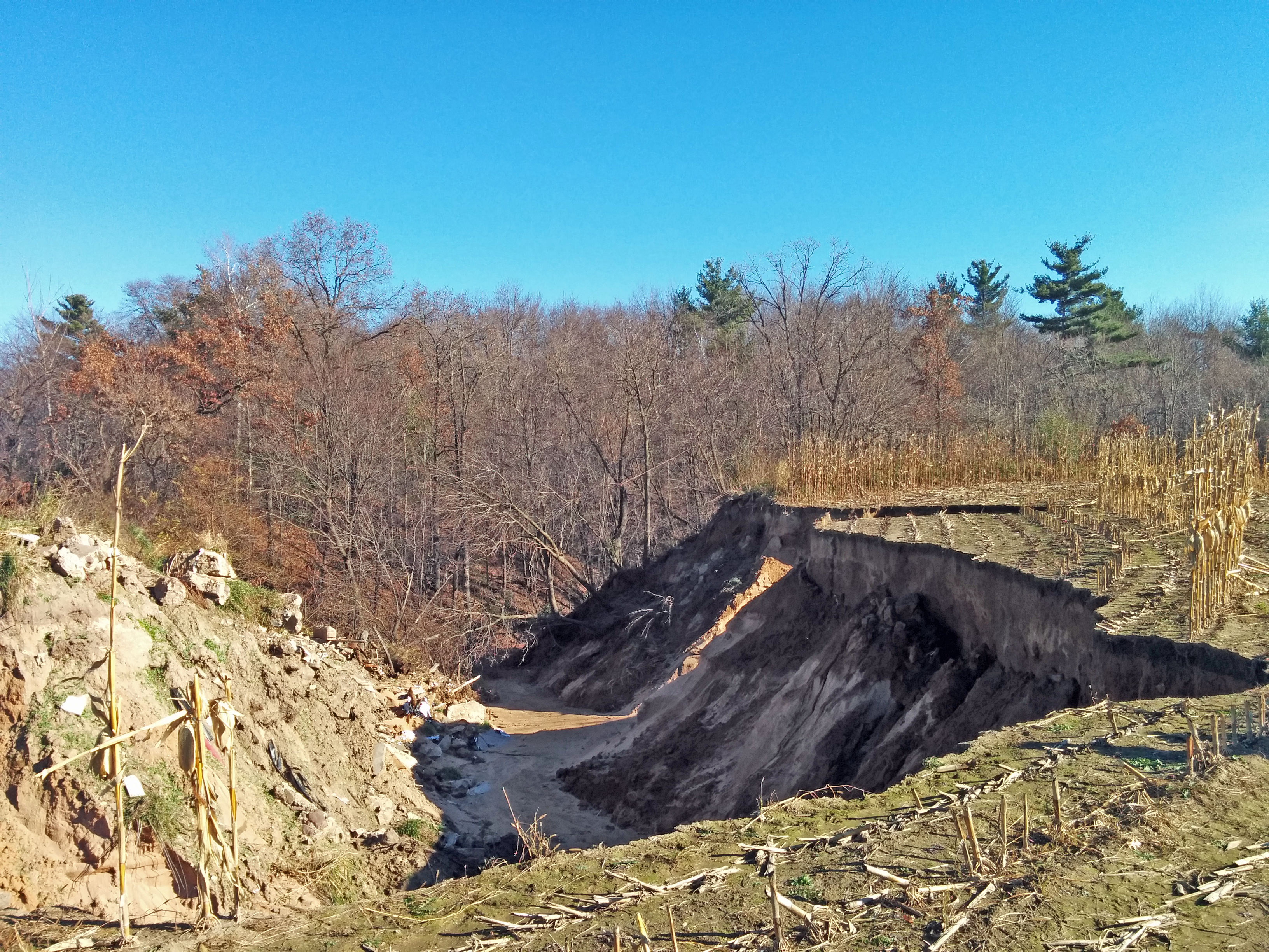
One of their crop fields backs up to a large wooded valley that drains rainwater into Trout Creek, a tributary feeding the Chippewa River. The channelized area is incredibly steep; dropping 25 feet into a wooded valley snaking around the edges of adjacent farm fields. Due to the naturally sandy soils, the Swoboda’s farmed with a berm between the crops and the edge of the field to minimize erosion from typical rainfalls.
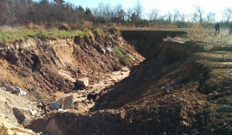
In mid-July 2016, huge rainfall events hit west central Wisconsin, causing significant flooding and related damages throughout the region. A single storm dumped eight inches of rain on the Swoboda’s farm, something Bryon Swoboda had never experienced before. The unprecedented volume of water pummeled the edges of his field and adjacent drainage ways. When the storm subsided, a gully the length of a football field was left running like a massive gash up the field.
“It looked like a tornado went through there,” said Bryon Swoboda. “We could have fit both our silos and the barn down in that washout. We had it sealed off with a berm … but I’m sure over the years, [rain] ate away at it until it was unstable, and then this storm just wiped it right out.”
Unable to secure federal disaster relief, the Swobodas turned to Chippewa County Department of Land Conservation and Forest Management (LCFM) for help. After an initial site evaluation, Chippewa LCFM and the Swoboda secured funding to fix the gully through the Wisconsin Department of Agriculture, Trade and Consumer Protection (DATCP)’s Soil and Water Resource Management (SWRM) grant program.
The grant program enabled Chippewa LCFM to approach the project thoroughly, conducting an engineering evaluation, a site topographic survey, and engineering design computations. Additionally, a comprehensive review of the operation was performed to assure compliance with DNR’s NR-151 standards.
Figuring out the best long-term solution to fix the gully came down to either a small dam or a rock-lined channel, which, as David Nashold, Chippewa LCFM Environmental Engineer noted, was a very pivotal decision for the project.
“We’ve done projects like this before, but we don’t often do these kinds of grade control structures, at least not as frequently as other counties in the region, where erosion control tends to dominate conservation projects,” Nashold said.
Nashold collaborated on design solutions with Patrick Schultz, DATCP’s Agricultural Engineer from Altoona, to determine the best solution.
“Although ponds are typically preferred, as they better control flooding and reduce the flow from rain events, this particular site was too flat for a good pond and would have flooded too large an area to be able to control the desired storm event,” said Schultz. “In the end, a rock-lined channel seemed to best fit the site and meet everyone’s goals.”
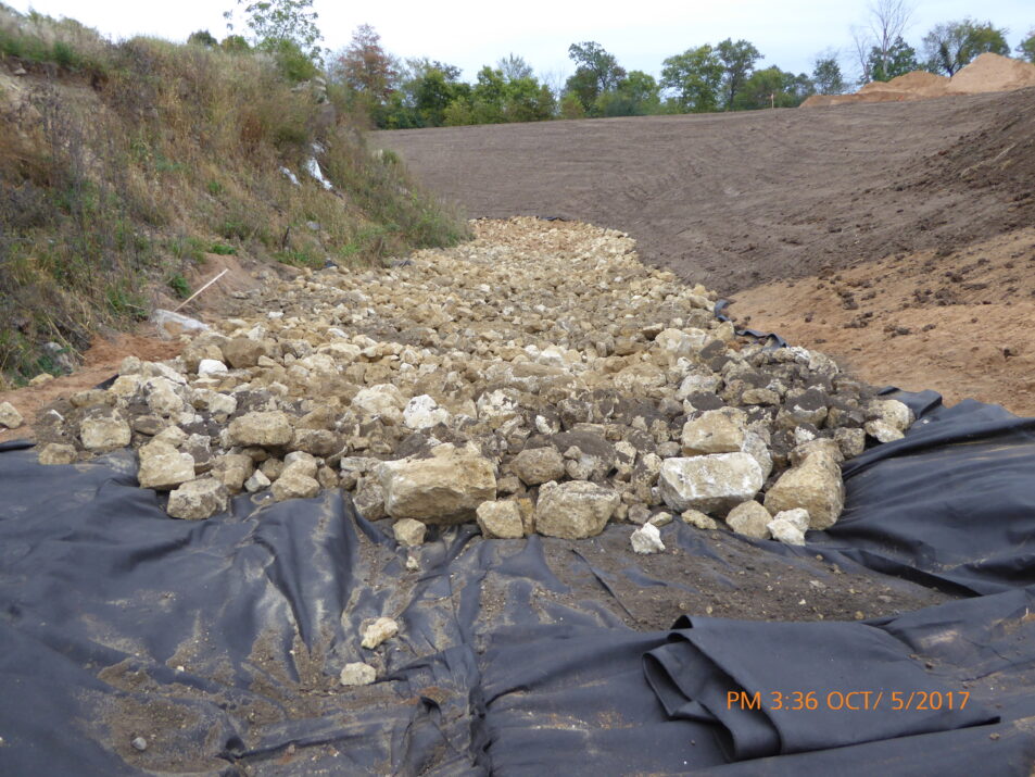
The rock-lined channel became the centerpiece to a creative solution that also included a system of water-diversion berms, grass buffers, and rock-checked dams.
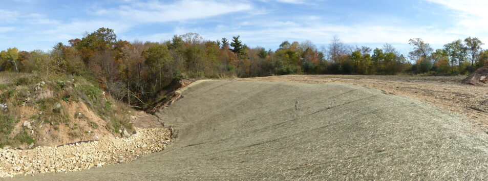
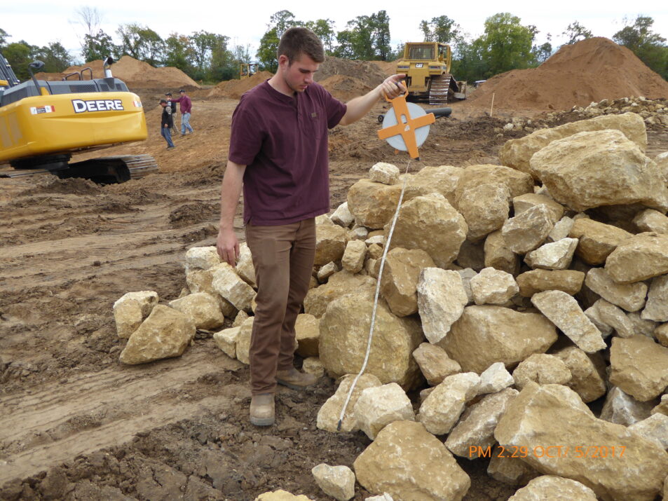
The south bank of the gully, where parts of the farm field had collapsed, were graded, seeded, and lined with erosion control blankets. The mouth, slope, and bottom of the gully were graded and reinforced with rock riprap to hold soil in place when high-volume storm events occur.
Additionally, a berm and grass buffer were built between the crop field and the waterway to catch runoff from the field and divert it to the head of the channel. From there, three rock-check dams, one at the mouth and two at the base, were installed to manage the volume of water that was being diverted into the channel.
By design, the channel is expected to withstand future rainfall events and effectively prevent further land loss.
“This was a significant conservation project for the region to curtail the loss of farmland and limit deposition of sediment into a trout stream,” said Nashold. “The project would not have been possible without SWRM funding for construction and conservation staff support.”
As Bryon Swoboda prepares for the next planting season, he says he feels good to have the project finished.
“We lost an acre of land, but even this year, I’d have lost more because of the water that is running down through there now,” said Swoboda. “It would have kept eroding into the field and caused more problems this year and into the future.”