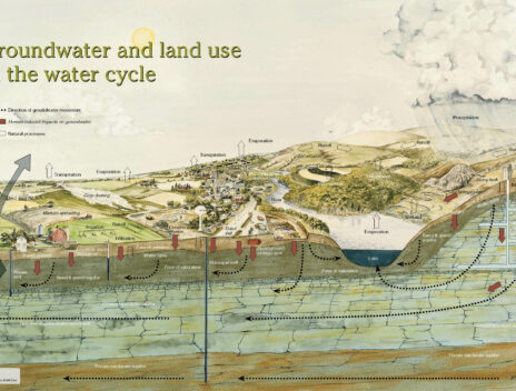
Groundwater
Wisconsin is blessed with an abundance of water resources that serve our drinking water needs. While one-third of the state draws drinking water from surface water sources (such as Lakes Michigan and Winnebago), the other two-thirds rely on groundwater. Understanding groundwater and how to protect it is a complex and emerging issue, and one that requires collaborative approaches between local and statewide partners.
Communities rely on county leadership to improve and protect water resources. Here you can find key resources developed by WI Land+Water and statewide partners to help counties integrate groundwater into county planning.
Identifying Partners
Find local partners and technical experts to support groundwater goals.
Understanding the Resources
Learn more about the groundwater data and mapping available in your county.

Communicating Results
Find tools to help communicate groundwater impacts with well owners and policy makers.

Providing Clean, Safe Water
Understand the opportunities available to ensure clean, safe drinking water to all Wisconsinites.